[Feature request] Size Field operator(x,y,z) port to Python API
Hi,
I'm hoping to get more flexibility in processing the size field and bring the size field into Python.
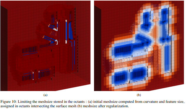
https://arxiv.org/pdf/2009.03984.pdf
Here is a workflow that I want to control the size field:
- Generate an initial size field using Gmsh's tools of Distance/Threshold/Min/Restrict etc
- Create a structured grid in Python. Evaluate the mesh size field on grid nodes. Such as
gmsh.field[FieldID].eval(x,y,z) - Perform arbitrary operations for the size field on the structured grid in Python, such as
- size gradient limiting @ https://arxiv.org/pdf/2009.03984.pdf
- numerical solution based size
- Using
Gmsh's Structured Fieldto load back the modified size field and generate the mesh.
BTW, the reason I want to use a structured grid due to it is fast to interpolate and efficient to storage as we don't need to save grid information like postview.
So could you add this kind of functionality? Or do you have a better idea about the workflow I proposed?
If this works, I plan to develop a python-based size field library for gmsh.
Thanks, Bin
Edited by Bin Wang