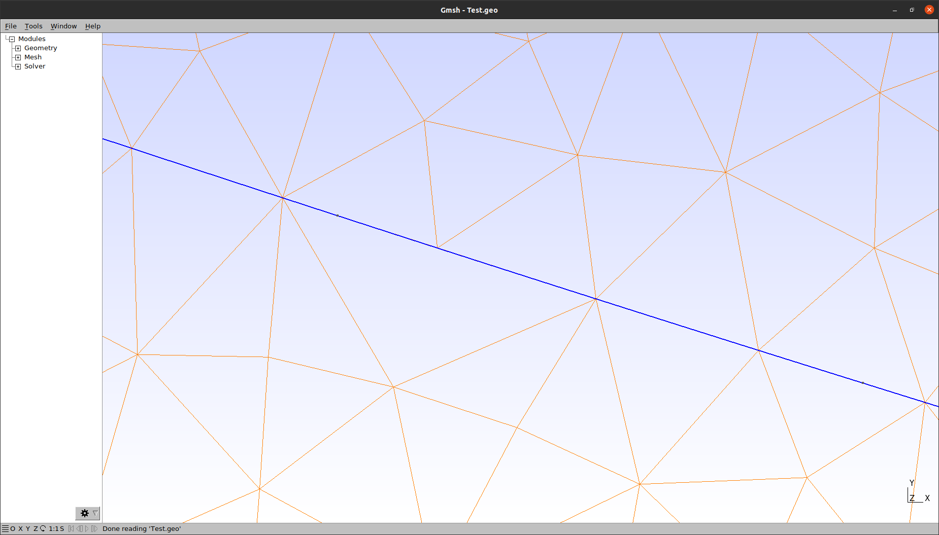
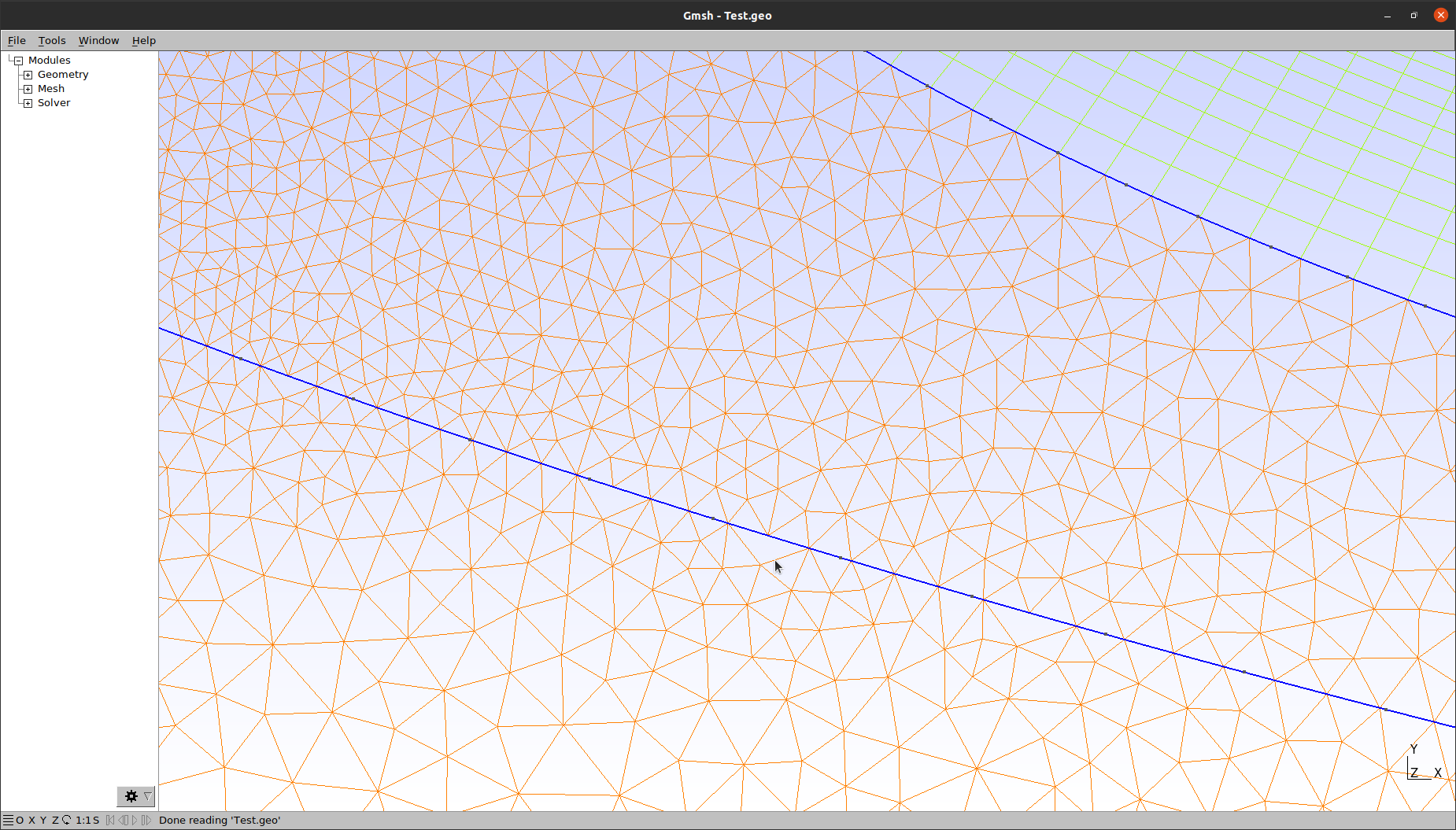
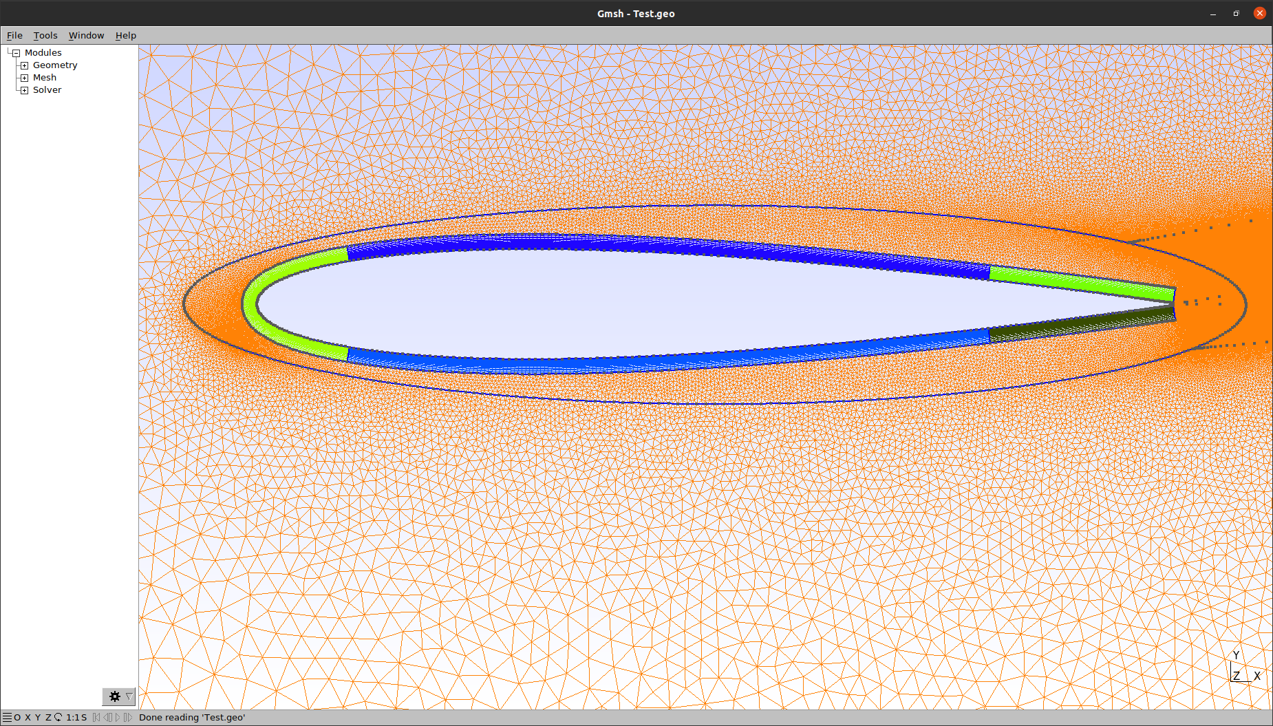
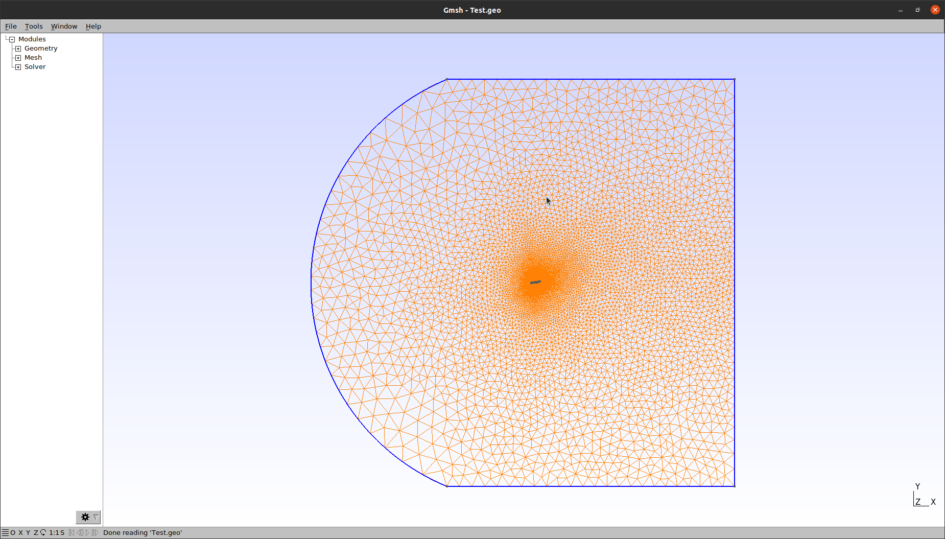
Structured - Unstructured grid: "skipped" elements
Hi everyone, I'm working on a Python code to automatically generate a grid for 2D airfoil (singular or multi-element). Since I want to leave free-variability to the user, the .geo file created becomes very large and complicated at first view. Anyway, I attach here an example of .geo file and some images about the issue: after meshing 2D, I find triangular in the unstructured region, which "skip" some nodes.
Then, although GMSH doesn't alert with an error, when I run on SU2 here there's a huge issue and non-physical solution, may causing no-convergence to my simulations. Changing some parameters (normal progression to wall surface, extending the structured region etc.) the issue changes position, but the issue sometimes still shows. Another strange feature is that the issue doesn't always present: for example, I was trying to validate farfield distance [50, 100, 225, 500, 750, 1000 chords], and the issue presented only when farfield distance increases around to 500 chords. Making adjustments to the grid only "delay" the issue to 600-700 farfield per chords' grids. I have found a way to avoid the problem by inserting the command "Mesh = 2": opening by terminal the .geo file issue doesn't show up; anyway, if I reload the script by GUI, grid changes and it shows the cited issue about missed elements. The strange fact (in my opinion) is this happens only in some occasions, with some features; not in any case with any geometry or parameter, like farfield distance. Down here you will find the .geo file with grid images on the entire domain and zoomed on the issue.
Thank you in advance for any suggestion, help or correction.
Stefano